- 02-160-1341
- the_sdg@ssru.ac.th

Lecturers of the Geography and Geoinformatics program explore the coral reef area with crewless aerial vehicles in the Ocean Account Project.
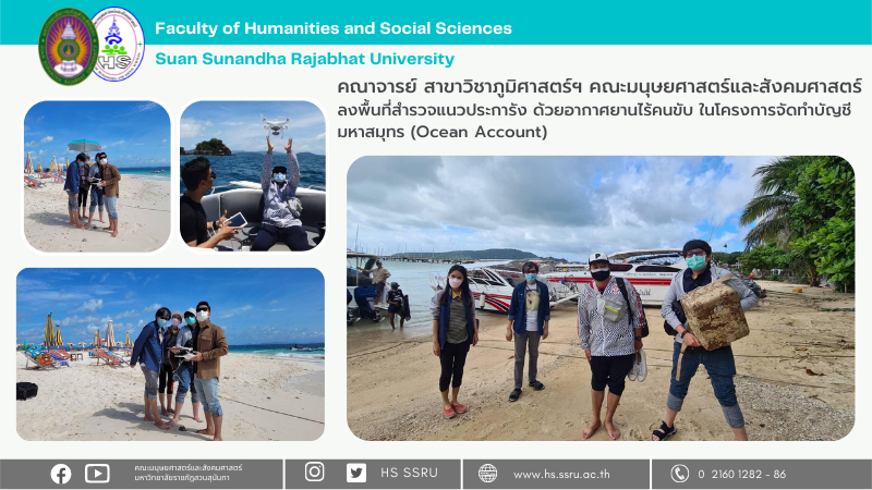
On July 29 – July 30 2022, Asst. Prof. Morakot Worachairungruang and Ajarn Nayot Kulpanich, lecturers of the Geography and Geoinformatics program in the Faculty of Humanities and Social Sciences, Suan Sunandha Rajabhat University, explore the coral reef area with the crewless aerial vehicles in the Ocean Account Project. The pilot project is in Phang Nga Bay in Phang Nga Province, Phuket Province, and Krabi Province by the Department of Marine and Coastal Resources (DTC), led by Asst. Prof. Dr. Walaiporn Phonphan, Head of the Department of Environmental Science. She led the survey team to Khai Island and Khai Nui Island in Phang Nga province.


Related posts:
Suan Sunandha Researchers hold hands with representatives from the private sector. Join forces to ad...
Academic Memorandum of Understanding Signing Ceremony to jointly develop students Communication Arts...
Products produced from the project to improve the quality of life of people in Udon Thani Province.